Sentinel-1 Products
In Terrascope, the following Sentinel-1 data products are provided:
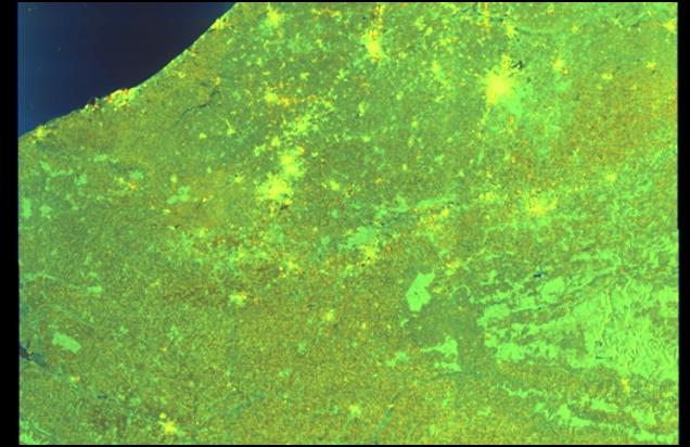
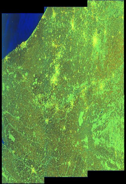
Sentinel-1 Level-1 Ground Range Detected (GRD) products
Level-1 Ground Range Detected (GRD) products consist of focused SAR data that has been detected, multi-looked and projected to ground range using an Earth ellipsoid model such as WGS84. The ellipsoid projection of the GRD products is corrected using the terrain height specified in the product general annotation. The terrain height used varies in azimuth but is constant in range. Ground range coordinates are the slant range coordinates projected onto the ellipsoid of the Earth. Pixel values represent detected amplitude. Phase information is lost. The resulting product has approximately square resolution pixels and square pixel spacing with reduced speckle at a cost of reduced spatial resolution. For the IW GRD products, multi-looking is performed on each burst individually. All bursts in all sub-swaths are then seamlessly merged to form a single, contiguous, ground range, detected image per polarisation.
| Property | Value |
|---|---|
| Spatial extent | [-180.0, -84.0, 180.0, 84.0] |
| Temporal extent | 2014/10/23 - Current |
| DOI | 10.71570/aafr-ks45 |
Sentinel-1 Level-1 Ground Range Detected (GRD) SIGMA0 products
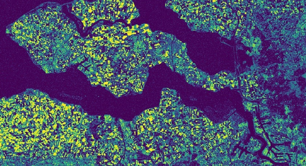
The Sigma0 product describes how much of the radar signal that was sent out by Sentinel-1 is reflected back to the sensor, and depends on the characteristics of the surface. This product is derived from the L1-GRD product. Typical SAR data processing, which produces level 1 images such as L1-GRD product, does not include radiometric corrections and significant radiometric bias remains. Therefore, it is necessary to apply the radiometric correction to SAR images so that the pixel values of the SAR images truly represent the radar backscatter of the reflecting surface. The radiometric correction is also necessary for the comparison of SAR images acquired with different sensors, or acquired from the same sensor but at different times, in different modes, or processed by different processors. For this Sigma0 product, radiometric calibration was performed using a specific Look Up Table (LUT) that is provided with each original GRD product. This LUT applies a range-dependent gain including the absolute calibration constant, in addition to a constant offset. Next to calibration, also orbit correction, border noise removal, thermal noise removal, and range doppler terrain correction steps were applied during production of Sigma0. The terrain correction step is intended to compensate for distortions due to topographical variations of the scene and the tilt of the satellite sensor, so that the geometric representation of the image will be as close as possible to the real world. The Level1 GRD product can be useful for Land monitoring and Emergency management.
| Property | Value |
|---|---|
| Spatial extent | [-180.0, -84.0, 180.0, 84.0] |
| Temporal extent | 2014/10/23 - Current |
| DOI | 10.71570/mfv3-t364 |
The Algorithm Theoretical Basis Document (ATBD) for this collection can be found here.
Sentinel-1 Level-1 Single Look Complex (SLC) products
Level-1 Single Look Complex (SLC) products consist of focused SAR data, geo-referenced using orbit and attitude data from the satellite, and provided in slant-range geometry. Slant range is the natural radar range observation coordinate, defined as the line-of-sight from the radar to each reflecting object. The products are in zero-Doppler orientation where each row of pixels represents points along a line perpendicular to the sub-satellite track. The products include a single look in each dimension using the full available signal bandwidth and complex samples (real and imaginary) preserving the phase information. The Interferometric Wide (IW) swath mode is the main acquisition mode over land and satisfies the majority of service requirements. It acquires data with a 250 km swath at 5 m by 20 m spatial resolution (single look). IW mode captures three sub-swaths using Terrain Observation with Progressive Scans SAR (TOPSAR). IW SLC products contain one image per sub-swath and one per polarisation channel, for a total of three (single polarisation) or six (dual polarisation) images in an IW product. Each sub-swath image consists of a series of bursts, where each burst has been processed as a separate SLC image. The individually focused complex burst images are included, in azimuth-time order, into a single sub-swath image with black-fill demarcation in between. There is sufficient overlap between adjacent bursts and between sub-swaths to ensure continuous coverage of the ground as provided in GRD products. The images for all bursts in all sub-swaths are resampled to a common pixel spacing grid in range and azimuth while preserving the phase information.
| Property | Value |
|---|---|
| Spatial extent | [-180.0, -84.0, 180.0, 84.0] |
| Temporal extent | 2014/10/23 - Current |
| DOI | 10.71570/pcmc-ky49 |
Sentinel-1 Level-1 Single Look Complex (SLC) Coherence products
The Interferometric Coherence product is the amplitude of the complex correlation coefficient between two images. In simple way, coherence describes similarity between two images in a range between zero to one. Zero means pixels were totally different where one means pixels were same exactly.The product algorithm starts from two ESA Level-1 SLC products which are from the same area, the same relative orbit number and preferably from within a short time interval (6 days is the shortest possible with S1A and S1B pairs). The original paired images go through a workflow of orbit correction, co-registration through back-geocoding, coherence calculation and terrain correction by making use of standard SNAP tools as part of the Sentinel-1 toolbox (S1TBX).The terrain correction step is intended to compensate for distortions due to topographical variations of the scene and the tilt of the satellite sensor, so that the geometric representation of the image will be as close as possible to the real world.
| Property | Value |
|---|---|
| Spatial extent | [-180.0, -84.0, 180.0, 84.0] |
| Temporal extent | 2014/10/23 - Current |
| DOI | 10.71570/hrbw-xr51 |
The Algorithm Theoretical Basis Document (ATBD) for this collection can be found here.
Back to top