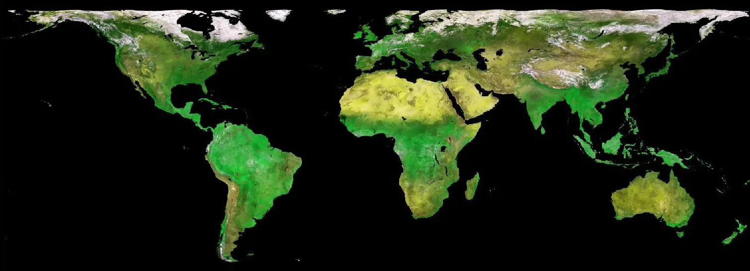
Terrascope
  • Overview
  • Get started
  • Introduction
    • Terrascope Introduction
    • The Copernicus Programme
    • Registration and authentication
  • Data
    • Sentinel Missions
    • Sentinel-1
    • Sentinel-2
    • Sentinel-3
    • Sentinel-5P
    • PROBA-V mission
    • PROBA-V
    • SPOT-VGT mission
    • SPOT-VGT
    • Additional Products
  • APIs
    • catalogue APIs
    • OpenSearch
    • TerraCatalogueClient
    • STAC
    • Product download
    • Streamlined Data Access APIs
    • openEO
    • Additional Web-services
    • CropSAR Service
    • Web Map Service (WMS)
    • Web Map Tile Service (WMTS)
  • Tools
    • Terrascope GUI
    • Terrascope Viewer
    • openEO web editor
    • Virtual Environments
    • Virtual Machine
    • JupyterLab
    • Hadoop Cluster
    • EOplaza
    • Getting started
    • Manage your Organisation
    • Publish a Service
    • Execute a Service
    • Manage a Service
    • Reporting
  • Quotas and Limitations
  • Support
    • Contact
    • Terrascope Forum
    • Terrascope Sample Examples
  • FAQ
  1. PROBA-V mission
  2. PROBA-V
  • Sentinel Missions
    • Sentinel-1
    • Sentinel-2
    • Sentinel-3
    • Sentinel-5P
  • PROBA-V mission
    • PROBA-V
  • SPOT-VGT mission
    • SPOT-VGT
  • Additional Products

On this page

  • PROBA-V L1C: radiometrically corrected raw data, given per strip/camera, HDF format - Collection 2
  • PROBA-V L2A: 100M projected segment data over Antarctica, COG format - Collection 1
  • PROBA-V L2A: 100M projected segment data over Antarctica, HDF format - Collection 1
  • PROBA-V L2A: 100M projected segment data, COG format - Collection 2
  • PROBA-V L2A: 100M projected segment data, HDF format - Collection 2
  • PROBA-V L2A: 1KM projected segment data over Antarctica, COG format - Collection 1
  • PROBA-V L2A: 1KM projected segment data over Antarctica, HDF format - Collection 1
  • PROBA-V L2A: 1KM projected segment data, COG format - Collection 2
  • PROBA-V L2A: 1KM projected segment data, HDF format - Collection 2
  • PROBA-V L2A: 300M projected segment data over Antarctica, COG format - Collection 1
  • PROBA-V L2A: 300M projected segment data over antarctica, HDF format- Collection 1
  • PROBA-V L2A: 300M projected segment data, COG format - Collection 2
  • PROBA-V L2A: 300M projected segment data, HDF format- Collection 2
  • PROBA-V S10 TOC 1 km COG: 10-day synthesis of S1s as Maximum Value Compositing (MVC), COG format - Collection 2
  • PROBA-V S10 TOC 1 km HDF: 10-day synthesis of S1s as Maximum Value Compositing (MVC), HDF format - Collection 2
  • PROBA-V S10 TOC 300 m COG: Decadal synthesis of S1’s as Maximum Value Compositing (MVC), COG format - Collection 2
  • PROBA-V S10 TOC 300 m HDF: Decadal synthesis of S1’s as Maximum Value Compositing (MVC), HDF format - Collection 2
  • PROBA-V S10 TOC NDVI 1 km COG: 10-day NDVI synthesis of S1s as Maximum Value Compositing (MVC), COG format, COG format - Collection 2
  • PROBA-V S10 TOC NDVI 1 km HDF: 10-day NDVI synthesis of S1s as Maximum Value Compositing (MVC), HDF format- Collection 2
  • PROBA-V S10 TOC NDVI 300 m COG: 10-day synthesis of S1s TOC as Maximum Value Compositing (MVC), COG format - Collection 2
  • PROBA-V S10 TOC NDVI 300 m HDF: 10-day synthesis of S1s TOC as Maximum Value Compositing (MVC), HDF format - Collection 2
  • PROBA-V S1 TOA 100m COG: 100 m resolution best-quality daily synthesis, COG format. Maximum Value Compositing (MVC) is applied - Collection 2
  • PROBA-V S1 TOA 100 m HDF: 100 m resolution best-quality daily synthesis, HDF format. Maximum Value Compositing (MVC) is applied - Collection 2
  • PROBA-V S1 TOA 1 km COG: 1 km resolution best-quality daily synthesis, COG format. Maximum Value Compositing (MVC) is applied - Collection 2
  • PROBA-V S1 TOA 1 km HDF: 1 km resolution best-quality daily synthesis, HDF format. Maximum Value Compositing (MVC) is applied - Collection 2
  • PROBA-V S1 TOA 300 m COG: 300 m resolution best-quality daily synthesis, COG format. Maximum Value Compositing (MVC) is applied - Collection 2
  • PROBA-V S1 TOA 300 m HDF: 300 m resolution best-quality daily synthesis, HDF format. Maximum Value Compositing (MVC) is applied - Collection 2
  • PROBA-V S1 TOC 100 m COG: Data corrected for atmospheric effects with the SMAC (Simplified Method for Atmosheric Corrections) algorithm, COG format - Collection 2
  • PROBA-V S1 TOC 100 m HDF: Data corrected for atmospheric effects with the SMAC (Simplified Method for Atmosheric Corrections) algorithm, HDF format - Collection 2
  • PROBA-V S1 TOC 1 km COG: Data corrected for atmospheric effects with the SMAC (Simplified Method for Atmosheric Corrections) algorithm, COG format - Collection 2
  • PROBA-V S1 TOC 1 km HDF: Data corrected for atmospheric effects with the SMAC (Simplified Method for Atmosheric Corrections) algorithm, HDF format - Collection 2
  • PROBA-V S1 TOC 300 m COG: Data corrected for atmospheric effects with the SMAC (Simplified Method for Atmosheric Corrections) algorithm, COG format - Collection 2
  • PROBA-V S1 TOC 300 m HDF: Data corrected for atmospheric effects with the SMAC (Simplified Method for Atmosheric Corrections) algorithm, HDF format - Collection 2
  • PROBA-V S1 TOC NDVI 100 m COG: Data corrected for atmospheric effects with the SMAC (Simplified Method for Atmosheric Corrections) algorithm, COG format - Collection 2
  • PROBA-V S1 NDVI TOC 100 m HDF: Data corrected for atmospheric effects with the SMAC (Simplified Method for Atmosheric Corrections) algorithm, HDF format - Collection 2
  • PROBA-V S5 TOA 100 m COG: 100 m resolution best-quality daily synthesis, COG format. Maximum Value Compositing (MVC) is applied - Collection 2
  • PROBA-V S5 TOA 100 m HDF: 100 m resolution best-quality 5-daily synthesis, HDF format. Maximum Value Compositing (MVC) is applied - Collection 2
  • PROBA-V S5 TOC 100 m COG: Data corrected for atmospheric effects with the SMAC (Simplified Method for Atmosheric Corrections) algorithm, COG format - Collection 2
  • PROBA-V S5 TOC 100 m HDF: Data corrected for atmospheric effects with the SMAC (Simplified Method for Atmosheric Corrections) algorithm, HDF format - Collection 2
  • PROBA-V S5 TOC NDVI 100 m COG: Data corrected for atmospheric effects with the SMAC (Simplified Method for Atmosheric Corrections) algorithm, COG format - Collection 2
  • PROBA-V S5 TOC NDVI 100 m HDF: Data corrected for atmospheric effects with the SMAC (Simplified Method for Atmosheric Corrections) algorithm, HDF format - Collection 2
  1. PROBA-V mission
  2. PROBA-V

PROBA-V Products

PROBA-V data products are available at various levels: Level 1C data comprise unprojected Top-of-Atmosphere (TOA) reflectances, while Level 2A data consist of projected segment TOA observations. Finally, the Level 3 data products are 10-day or 5-day Top-of-Canopy (TOC) composites, and 1-day TOA and TOC composites. Figure 1 shows the processing streams for the various PROBA-V data product levels.

Please note that PROBA-V’s operational phase has ended as of 30 June 2020, the data coverage beyond this date is limited to Europe and Africa and is for scientific/experimental use only. As per 31 October 2021, this experimental phase ended and PROBA-V’s instruments were switched off.

Collection 2, which includes among others improvements in the cloud and snow/ice detection, improved atmospheric correction, radiometric improvements, as well as updated data and metadata formats, was released in March 2023. Collection 2 contains the entire archive spanning 16 October 2013 - 30 June 2020. All relevant information and documentation, inluding the evaluation report and Product User Manual, is available on the PROBA-V website. Detailed information on algorithm changes in Collection 2 is available here.

PROBA-V L1C: radiometrically corrected raw data, given per strip/camera, HDF format - Collection 2

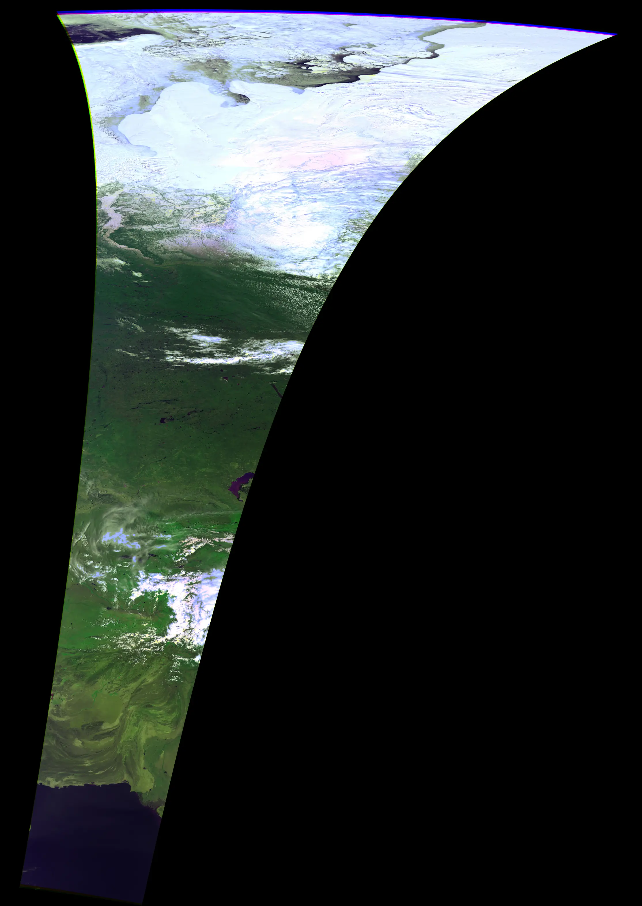
Radiometrically corrected Level 1B data (i.e. unprojected TOA reflectance), given per strip/camera. Pixel digital numbers are converted to radiance values. Image remains in raw sensor geometry (unprojected). The spatial resolution varies between 100 and 300 for VNIR and between 200 and 600 for SWIR.

Thumbnail - PROBA-V L1C: radiometrically corrected raw data, given per strip/camera, HDF format - Collection 2
Open in STAC
Property Value
Spatial extent [-179.999, -56, 179.999, 75]
Temporal extent 2013/10/16 - 2020/06/30

PROBA-V L2A: 100M projected segment data over Antarctica, COG format - Collection 1

A Level2A product contains the projected Level1C data, i.e. radiometrically and geometrically corrected TOA reflectance values projected on a uniform grid, given per band/camera. The applied coordinate reference system is the “Geographic Lat/Lon” (EPSG:4326) projection with a spatial resolution of 100 m.

Thumbnail - PROBA-V L2A: 100M projected segment data over Antarctica, COG format - Collection 1
Open in STAC
Property Value
Spatial extent [-179.999, -56, 179.999, 75]
Temporal extent 2013/10/16 - 2020/06/30

PROBA-V L2A: 100M projected segment data over Antarctica, HDF format - Collection 1

A Level2A product contains the projected Level1C data, i.e. radiometrically and geometrically corrected TOA reflectance values projected on a uniform grid, given per band/camera. The applied coordinate reference system is the “Geographic Lat/Lon” (EPSG:4326) projection with a spatial resolution of 100 m.

Thumbnail - PROBA-V L2A: 100M projected segment data over Antarctica, HDF format - Collection 1
Open in STAC
Property Value
Spatial extent [-179.999, -56, 179.999, 75]
Temporal extent 2013/10/16 - 2020/06/30

PROBA-V L2A: 100M projected segment data, COG format - Collection 2

A Level2A product contains the projected Level1C data, i.e. radiometrically and geometrically corrected TOA reflectance values projected on a uniform grid, given per band/camera. The applied coordinate reference system is the “Geographic Lat/Lon” (EPSG:4326) projection with a spatial resolution of 100 m.

Thumbnail - PROBA-V L2A: 100M projected segment data, COG format - Collection 2
Open in STAC
Property Value
Spatial extent [-179.999, -56, 179.999, 75]
Temporal extent 2013/10/16 - 2020/06/30

PROBA-V L2A: 100M projected segment data, HDF format - Collection 2

A Level2A product contains the projected Level1C data, i.e. radiometrically and geometrically corrected TOA reflectance values projected on a uniform grid, given per band/camera. The applied coordinate reference system is the “Geographic Lat/Lon” (EPSG:4326) projection with a spatial resolution of 100 m.

Thumbnail - PROBA-V L2A: 100M projected segment data, HDF format - Collection 2
Open in STAC
Property Value
Spatial extent [-179.999, -56, 179.999, 75]
Temporal extent 2013/10/16 - 2020/06/30

PROBA-V L2A: 1KM projected segment data over Antarctica, COG format - Collection 1

A Level2A product contains the projected Level1C data, i.e. radiometrically and geometrically corrected TOA reflectance values projected on a uniform grid, given per band/camera. The applied coordinate reference system is the “Geographic Lat/Lon” (EPSG:4326) projection with a spatial resolution of 1 km.

Thumbnail - PROBA-V L2A: 1KM projected segment data over Antarctica, COG format - Collection 1
Open in STAC
Property Value
Spatial extent [-179.999, -56, 179.999, 75]
Temporal extent 2013/10/16 - 2020/06/30

PROBA-V L2A: 1KM projected segment data over Antarctica, HDF format - Collection 1

A Level2A product contains the projected Level1C data, i.e. radiometrically and geometrically corrected TOA reflectance values projected on a uniform grid, given per band/camera. The applied coordinate reference system is the “Geographic Lat/Lon” (EPSG:4326) projection with a spatial resolution of 1 km.

Thumbnail - PROBA-V L2A: 1KM projected segment data over Antarctica, HDF format - Collection 1
Open in STAC
Property Value
Spatial extent [-179.999, -56, 179.999, 75]
Temporal extent 2013/10/16 - 2020/06/30

PROBA-V L2A: 1KM projected segment data, COG format - Collection 2

A Level2A product contains the projected Level1C data, i.e. radiometrically and geometrically corrected TOA reflectance values projected on a uniform grid, given per band/camera. The applied coordinate reference system is the “Geographic Lat/Lon” (EPSG:4326) projection with a spatial resolution of 1 km.

Thumbnail - PROBA-V L2A: 1KM projected segment data, COG format - Collection 2
Open in STAC
Property Value
Spatial extent [-179.999, -56, 179.999, 75]
Temporal extent 2013/10/16 - 2020/06/30

PROBA-V L2A: 1KM projected segment data, HDF format - Collection 2

A Level2A product contains the projected Level1C data, i.e. radiometrically and geometrically corrected TOA reflectance values projected on a uniform grid, given per band/camera. The applied coordinate reference system is the “Geographic Lat/Lon” (EPSG:4326) projection with a spatial resolution of 1 km.

Thumbnail - PROBA-V L2A: 1KM projected segment data, HDF format - Collection 2
Open in STAC
Property Value
Spatial extent [-179.999, -56, 179.999, 75]
Temporal extent 2013/10/16 - 2020/06/30

PROBA-V L2A: 300M projected segment data over Antarctica, COG format - Collection 1

A Level2A product contains the projected Level1C data, i.e. radiometrically and geometrically corrected TOA reflectance values projected on a uniform grid, given per band/camera. The applied coordinate reference system is the “Geographic Lat/Lon” (EPSG:4326) projection with a spatial resolution of 333 m.

Thumbnail - PROBA-V L2A: 300M projected segment data over Antarctica, COG format - Collection 1
Open in STAC
Property Value
Spatial extent [-179.999, -56, 179.999, 75]
Temporal extent 2013/10/16 - 2020/06/30

PROBA-V L2A: 300M projected segment data over antarctica, HDF format- Collection 1

A Level2A product contains the projected Level1C data, i.e. radiometrically and geometrically corrected TOA reflectance values projected on a uniform grid, given per band/camera. The applied coordinate reference system is the “Geographic Lat/Lon” (EPSG:4326) projection with a spatial resolution of 333 m.

Thumbnail - PROBA-V L2A: 300M projected segment data over antarctica, HDF format- Collection 1
Open in STAC
Property Value
Spatial extent [-179.999, -56, 179.999, 75]
Temporal extent 2013/10/16 - 2020/06/30

PROBA-V L2A: 300M projected segment data, COG format - Collection 2

A Level2A product contains the projected Level1C data, i.e. radiometrically and geometrically corrected TOA reflectance values projected on a uniform grid, given per band/camera. The applied coordinate reference system is the “Geographic Lat/Lon” (EPSG:4326) projection with a spatial resolution of 333 m.

Thumbnail - PROBA-V L2A: 300M projected segment data, COG format - Collection 2
Open in STAC
Property Value
Spatial extent [-179.999, -56, 179.999, 75]
Temporal extent 2013/10/16 - 2020/06/30

PROBA-V L2A: 300M projected segment data, HDF format- Collection 2

A Level2A product contains the projected Level1C data, i.e. radiometrically and geometrically corrected TOA reflectance values projected on a uniform grid, given per band/camera. The applied coordinate reference system is the “Geographic Lat/Lon” (EPSG:4326) projection with a spatial resolution of 333 m.

Thumbnail - PROBA-V L2A: 300M projected segment data, HDF format- Collection 2
Open in STAC
Property Value
Spatial extent [-179.999, -56, 179.999, 75]
Temporal extent 2013/10/16 - 2020/06/30

PROBA-V S10 TOC 1 km COG: 10-day synthesis of S1s as Maximum Value Compositing (MVC), COG format - Collection 2

Level 3 data products are variables mapped on uniform space-time grid scales and are the result of combining multiple scenes (e.g. S1/S5/S10) to cover the user region of interest.

Thumbnail - PROBA-V S10 TOC 1 km COG: 10-day synthesis of S1s as Maximum Value Compositing (MVC), COG format - Collection 2
Open in STAC
Property Value
Spatial extent [-179.999, -56, 179.999, 75]
Temporal extent 2013/10/16 - 2020/06/30

PROBA-V S10 TOC 1 km HDF: 10-day synthesis of S1s as Maximum Value Compositing (MVC), HDF format - Collection 2

Level 3 data products are variables mapped on uniform space-time grid scales and are the result of combining multiple scenes (e.g. S1/S5/S10) to cover the user region of interest.

Thumbnail - PROBA-V S10 TOC 1 km HDF: 10-day synthesis of S1s as Maximum Value Compositing (MVC), HDF format - Collection 2
Open in STAC
Property Value
Spatial extent [-179.999, -56, 179.999, 75]
Temporal extent 2013/10/16 - 2020/06/30

PROBA-V S10 TOC 300 m COG: Decadal synthesis of S1’s as Maximum Value Compositing (MVC), COG format - Collection 2

Level 3 data products are variables mapped on uniform space-time grid scales and are the result of combining multiple scenes (e.g. S1/S5/S10) to cover the user region of interest.

Thumbnail - PROBA-V S10 TOC 300 m COG: Decadal synthesis of S1's as Maximum Value Compositing (MVC), COG format - Collection 2
Open in STAC
Property Value
Spatial extent [-179.999, -56, 179.999, 75]
Temporal extent 2013/10/16 - 2020/06/30

PROBA-V S10 TOC 300 m HDF: Decadal synthesis of S1’s as Maximum Value Compositing (MVC), HDF format - Collection 2

Level 3 data products are variables mapped on uniform space-time grid scales and are the result of combining multiple scenes (e.g. S1/S5/S10) to cover the user region of interest.

Thumbnail - PROBA-V S10 TOC 300 m HDF: Decadal synthesis of S1's as Maximum Value Compositing (MVC), HDF format - Collection 2
Open in STAC
Property Value
Spatial extent [-179.999, -56, 179.999, 75]
Temporal extent 2013/10/16 - 2020/06/30

PROBA-V S10 TOC NDVI 1 km COG: 10-day NDVI synthesis of S1s as Maximum Value Compositing (MVC), COG format, COG format - Collection 2

Level 3 data products are variables mapped on uniform space-time grid scales and are the result of combining multiple scenes (e.g. S1/S5/S10) to cover the user region of interest.

Thumbnail - PROBA-V S10 TOC NDVI 1 km COG: 10-day NDVI synthesis of S1s as Maximum Value Compositing (MVC), COG format, COG format - Collection 2
Open in STAC
Property Value
Spatial extent [-179.999, -56, 179.999, 75]
Temporal extent 2013/10/16 - 2020/06/30

PROBA-V S10 TOC NDVI 1 km HDF: 10-day NDVI synthesis of S1s as Maximum Value Compositing (MVC), HDF format- Collection 2

Level 3 data products are variables mapped on uniform space-time grid scales and are the result of combining multiple scenes (e.g. S1/S5/S10) to cover the user region of interest.

Thumbnail - PROBA-V S10 TOC NDVI 1 km HDF: 10-day NDVI synthesis of S1s as Maximum Value Compositing (MVC), HDF format- Collection 2
Open in STAC
Property Value
Spatial extent [-179.999, -56, 179.999, 75]
Temporal extent 2013/10/16 - 2020/06/30

PROBA-V S10 TOC NDVI 300 m COG: 10-day synthesis of S1s TOC as Maximum Value Compositing (MVC), COG format - Collection 2

Level 3 data products are variables mapped on uniform space-time grid scales and are the result of combining multiple scenes (e.g. S1/S5/S10) to cover the user region of interest.

Thumbnail - PROBA-V S10 TOC NDVI 300 m COG: 10-day synthesis of S1s TOC as Maximum Value Compositing (MVC), COG format - Collection 2
Open in STAC
Property Value
Spatial extent [-179.999, -56, 179.999, 75]
Temporal extent 2013/10/16 - 2020/06/30

PROBA-V S10 TOC NDVI 300 m HDF: 10-day synthesis of S1s TOC as Maximum Value Compositing (MVC), HDF format - Collection 2

Level 3 data products are variables mapped on uniform space-time grid scales and are the result of combining multiple scenes (e.g. S1/S5/S10) to cover the user region of interest.

Thumbnail - PROBA-V S10 TOC NDVI 300 m HDF: 10-day synthesis of S1s TOC as Maximum Value Compositing (MVC), HDF format - Collection 2
Open in STAC
Property Value
Spatial extent [-179.999, -56, 179.999, 75]
Temporal extent 2013/10/16 - 2020/06/30

PROBA-V S1 TOA 100m COG: 100 m resolution best-quality daily synthesis, COG format. Maximum Value Compositing (MVC) is applied - Collection 2

Level 3 data products are variables mapped on uniform space-time grid scales and are the result of combining multiple scenes (e.g. S1/S10) to cover the user region of interest.

Thumbnail - PROBA-V S1 TOA 100m COG: 100 m resolution best-quality daily synthesis, COG format. Maximum Value Compositing (MVC) is applied - Collection 2
Open in STAC
Property Value
Spatial extent [-179.999, -56, 179.999, 75]
Temporal extent 2013/10/16 - 2020/06/30

PROBA-V S1 TOA 100 m HDF: 100 m resolution best-quality daily synthesis, HDF format. Maximum Value Compositing (MVC) is applied - Collection 2

Level 3 data products are variables mapped on uniform space-time grid scales and are the result of combining multiple scenes (e.g. S1/S10) to cover the user region of interest.

Thumbnail - PROBA-V S1 TOA 100 m HDF: 100 m resolution best-quality daily synthesis, HDF format. Maximum Value Compositing (MVC) is applied - Collection 2
Open in STAC
Property Value
Spatial extent [-179.999, -56, 179.999, 75]
Temporal extent 2013/10/16 - 2020/06/30

PROBA-V S1 TOA 1 km COG: 1 km resolution best-quality daily synthesis, COG format. Maximum Value Compositing (MVC) is applied - Collection 2

Level 3 data products are variables mapped on uniform space-time grid scales and are the result of combining multiple scenes (e.g. S1/S10) to cover the user region of interest.

Thumbnail - PROBA-V S1 TOA 1 km COG: 1 km resolution best-quality daily synthesis, COG format. Maximum Value Compositing (MVC) is applied - Collection 2
Open in STAC
Property Value
Spatial extent [-179.999, -56, 179.999, 75]
Temporal extent 2013/10/16 - 2020/06/30

PROBA-V S1 TOA 1 km HDF: 1 km resolution best-quality daily synthesis, HDF format. Maximum Value Compositing (MVC) is applied - Collection 2

Level 3 data products are variables mapped on uniform space-time grid scales and are the result of combining multiple scenes (e.g. S1/S10) to cover the user region of interest.

Thumbnail - PROBA-V S1 TOA 1 km HDF: 1 km resolution best-quality daily synthesis, HDF format. Maximum Value Compositing (MVC) is applied - Collection 2
Open in STAC
Property Value
Spatial extent [-179.999, -56, 179.999, 75]
Temporal extent 2013/10/16 - 2020/06/30

PROBA-V S1 TOA 300 m COG: 300 m resolution best-quality daily synthesis, COG format. Maximum Value Compositing (MVC) is applied - Collection 2

Level 3 data products are variables mapped on uniform space-time grid scales and are the result of combining multiple scenes (e.g. S1/S10) to cover the user region of interest.

Thumbnail - PROBA-V S1 TOA 300 m COG: 300 m resolution best-quality daily synthesis, COG format. Maximum Value Compositing (MVC) is applied - Collection 2
Open in STAC
Property Value
Spatial extent [-179.999, -56, 179.999, 75]
Temporal extent 2013/10/16 - 2020/06/30

PROBA-V S1 TOA 300 m HDF: 300 m resolution best-quality daily synthesis, HDF format. Maximum Value Compositing (MVC) is applied - Collection 2

Level 3 data products are variables mapped on uniform space-time grid scales and are the result of combining multiple scenes (e.g. S1/S10) to cover the user region of interest.

Thumbnail - PROBA-V S1 TOA 300 m HDF: 300 m resolution best-quality daily synthesis, HDF format. Maximum Value Compositing (MVC) is applied - Collection 2
Open in STAC
Property Value
Spatial extent [-179.999, -56, 179.999, 75]
Temporal extent 2013/10/16 - 2020/06/30

PROBA-V S1 TOC 100 m COG: Data corrected for atmospheric effects with the SMAC (Simplified Method for Atmosheric Corrections) algorithm, COG format - Collection 2

Level 3 data products are variables mapped on uniform space-time grid scales and are the result of combining multiple scenes (e.g. S1/S10) to cover the user region of interest.

Thumbnail - PROBA-V S1 TOC 100 m COG: Data corrected for atmospheric effects with the SMAC (Simplified Method for Atmosheric Corrections) algorithm, COG format - Collection 2
Open in STAC
Property Value
Spatial extent [-179.999, -56, 179.999, 75]
Temporal extent 2013/10/16 - 2020/06/30

PROBA-V S1 TOC 100 m HDF: Data corrected for atmospheric effects with the SMAC (Simplified Method for Atmosheric Corrections) algorithm, HDF format - Collection 2

Level 3 data products are variables mapped on uniform space-time grid scales and are the result of combining multiple scenes (e.g. S1/S10) to cover the user region of interest.

Thumbnail - PROBA-V S1 TOC 100 m HDF: Data corrected for atmospheric effects with the SMAC (Simplified Method for Atmosheric Corrections) algorithm, HDF format - Collection 2
Open in STAC
Property Value
Spatial extent [-179.999, -56, 179.999, 75]
Temporal extent 2013/10/16 - 2020/06/30

PROBA-V S1 TOC 1 km COG: Data corrected for atmospheric effects with the SMAC (Simplified Method for Atmosheric Corrections) algorithm, COG format - Collection 2

Level 3 data products are variables mapped on uniform space-time grid scales and are the result of combining multiple scenes (e.g. S1/S10) to cover the user region of interest.

Thumbnail - PROBA-V S1 TOC 1 km COG: Data corrected for atmospheric effects with the SMAC (Simplified Method for Atmosheric Corrections) algorithm, COG format - Collection 2
Open in STAC
Property Value
Spatial extent [-179.999, -56, 179.999, 75]
Temporal extent 2013/10/16 - 2020/06/30

PROBA-V S1 TOC 1 km HDF: Data corrected for atmospheric effects with the SMAC (Simplified Method for Atmosheric Corrections) algorithm, HDF format - Collection 2

Level 3 data products are variables mapped on uniform space-time grid scales and are the result of combining multiple scenes (e.g. S1/S10) to cover the user region of interest.

Thumbnail - PROBA-V S1 TOC 1 km HDF: Data corrected for atmospheric effects with the SMAC (Simplified Method for Atmosheric Corrections) algorithm, HDF format - Collection 2
Open in STAC
Property Value
Spatial extent [-179.999, -56, 179.999, 75]
Temporal extent 2013/10/16 - 2020/06/30

PROBA-V S1 TOC 300 m COG: Data corrected for atmospheric effects with the SMAC (Simplified Method for Atmosheric Corrections) algorithm, COG format - Collection 2

Level 3 data products are variables mapped on uniform space-time grid scales and are the result of combining multiple scenes (e.g. S1/S10) to cover the user region of interest.

Thumbnail - PROBA-V S1 TOC 300 m COG: Data corrected for atmospheric effects with the SMAC (Simplified Method for Atmosheric Corrections) algorithm, COG format - Collection 2
Open in STAC
Property Value
Spatial extent [-179.999, -56, 179.999, 75]
Temporal extent 2013/10/16 - 2020/06/30

PROBA-V S1 TOC 300 m HDF: Data corrected for atmospheric effects with the SMAC (Simplified Method for Atmosheric Corrections) algorithm, HDF format - Collection 2

Level 3 data products are variables mapped on uniform space-time grid scales and are the result of combining multiple scenes (e.g. S1/S10) to cover the user region of interest.

Thumbnail - PROBA-V S1 TOC 300 m HDF: Data corrected for atmospheric effects with the SMAC (Simplified Method for Atmosheric Corrections) algorithm, HDF format - Collection 2
Open in STAC
Property Value
Spatial extent [-179.999, -56, 179.999, 75]
Temporal extent 2013/10/16 - 2020/06/30

PROBA-V S1 TOC NDVI 100 m COG: Data corrected for atmospheric effects with the SMAC (Simplified Method for Atmosheric Corrections) algorithm, COG format - Collection 2

Level 3 data products are variables mapped on uniform space-time grid scales and are the result of combining multiple scenes (e.g. S1/S10) to cover the user region of interest.

Thumbnail - PROBA-V S1 TOC NDVI 100 m COG: Data corrected for atmospheric effects with the SMAC (Simplified Method for Atmosheric Corrections) algorithm, COG format - Collection 2
Open in STAC
Property Value
Spatial extent [-179.999, -56, 179.999, 75]
Temporal extent 2013/10/16 - 2020/06/30

PROBA-V S1 NDVI TOC 100 m HDF: Data corrected for atmospheric effects with the SMAC (Simplified Method for Atmosheric Corrections) algorithm, HDF format - Collection 2

Level 3 data products are variables mapped on uniform space-time grid scales and are the result of combining multiple scenes (e.g. S1/S10) to cover the user region of interest.

Thumbnail - PROBA-V S1 NDVI TOC 100 m HDF: Data corrected for atmospheric effects with the SMAC (Simplified Method for Atmosheric Corrections) algorithm, HDF format - Collection 2
Open in STAC
Property Value
Spatial extent [-179.999, -56, 179.999, 75]
Temporal extent 2013/10/16 - 2020/06/30

PROBA-V S5 TOA 100 m COG: 100 m resolution best-quality daily synthesis, COG format. Maximum Value Compositing (MVC) is applied - Collection 2

Level 3 data products are variables mapped on uniform space-time grid scales and are the result of combining multiple scenes (e.g. S1/S5/S10) to cover the user region of interest.

Thumbnail - PROBA-V S5 TOA 100 m COG: 100 m resolution best-quality daily synthesis, COG format. Maximum Value Compositing (MVC) is applied - Collection 2
Open in STAC
Property Value
Spatial extent [-179.999, -56, 179.999, 75]
Temporal extent 2013/10/16 - 2020/06/30

PROBA-V S5 TOA 100 m HDF: 100 m resolution best-quality 5-daily synthesis, HDF format. Maximum Value Compositing (MVC) is applied - Collection 2

Level 3 data products are variables mapped on uniform space-time grid scales and are the result of combining multiple scenes (e.g. S1/S5/S10) to cover the user region of interest.

Thumbnail - PROBA-V S5 TOA 100 m HDF: 100 m resolution best-quality 5-daily synthesis, HDF format. Maximum Value Compositing (MVC) is applied - Collection 2
Open in STAC
Property Value
Spatial extent [-179.999, -56, 179.999, 75]
Temporal extent 2013/10/16 - 2020/06/30

PROBA-V S5 TOC 100 m COG: Data corrected for atmospheric effects with the SMAC (Simplified Method for Atmosheric Corrections) algorithm, COG format - Collection 2

Level 3 data products are variables mapped on uniform space-time grid scales and are the result of combining multiple scenes (e.g. S1/S5/S10) to cover the user region of interest.

Thumbnail - PROBA-V S5 TOC 100 m COG: Data corrected for atmospheric effects with the SMAC (Simplified Method for Atmosheric Corrections) algorithm, COG format - Collection 2
Open in STAC
Property Value
Spatial extent [-179.999, -56, 179.999, 75]
Temporal extent 2013/10/16 - 2020/06/30

PROBA-V S5 TOC 100 m HDF: Data corrected for atmospheric effects with the SMAC (Simplified Method for Atmosheric Corrections) algorithm, HDF format - Collection 2

Level 3 data products are variables mapped on uniform space-time grid scales and are the result of combining multiple scenes (e.g. S1/S5/S10) to cover the user region of interest.

Thumbnail - PROBA-V S5 TOC 100 m HDF: Data corrected for atmospheric effects with the SMAC (Simplified Method for Atmosheric Corrections) algorithm, HDF format - Collection 2
Open in STAC
Property Value
Spatial extent [-179.999, -56, 179.999, 75]
Temporal extent 2013/10/16 - 2020/06/30

PROBA-V S5 TOC NDVI 100 m COG: Data corrected for atmospheric effects with the SMAC (Simplified Method for Atmosheric Corrections) algorithm, COG format - Collection 2

Level 3 data products are variables mapped on uniform space-time grid scales and are the result of combining multiple scenes (e.g. S1/S5/S10) to cover the user region of interest.

Thumbnail - PROBA-V S5 TOC NDVI 100 m COG: Data corrected for atmospheric effects with the SMAC (Simplified Method for Atmosheric Corrections) algorithm, COG format - Collection 2
Open in STAC
Property Value
Spatial extent [-179.999, -56, 179.999, 75]
Temporal extent 2013/10/16 - 2020/06/30

PROBA-V S5 TOC NDVI 100 m HDF: Data corrected for atmospheric effects with the SMAC (Simplified Method for Atmosheric Corrections) algorithm, HDF format - Collection 2

Level 3 data products are variables mapped on uniform space-time grid scales and are the result of combining multiple scenes (e.g. S1/S5/S10) to cover the user region of interest.

Thumbnail - PROBA-V S5 TOC NDVI 100 m HDF: Data corrected for atmospheric effects with the SMAC (Simplified Method for Atmosheric Corrections) algorithm, HDF format - Collection 2
Open in STAC
Property Value
Spatial extent [-179.999, -56, 179.999, 75]
Temporal extent 2013/10/16 - 2020/06/30
Back to top
Sentinel-5P
SPOT-VGT

Copyright 2018 - 2024 VITO NV All Rights reserved

 
  • Terms of Use

  • Privacy declaration

  • Cookie Policy

  • Contact