Sentinel-5P/TROPOMI Products
Terrascope provides daily, monthly, and yearly averaged atmospheric column abundances of these gases in the atmosphere:
- nitrogen dioxide (NO2) - global
- nitrogen dioxide (NO2) - improved European product using CAMS
- nitrogen dioxide (NO2) - local European surface level
- carbon monoxide (CO)
- methane (CH4)
- formaldehyde (HCHO)
- sulfur dioxide (SO2)
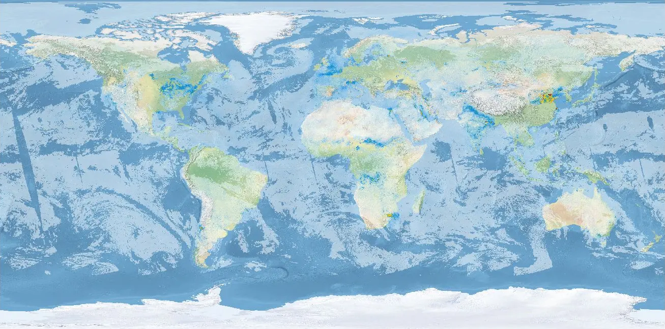
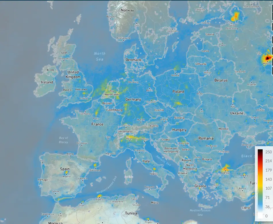
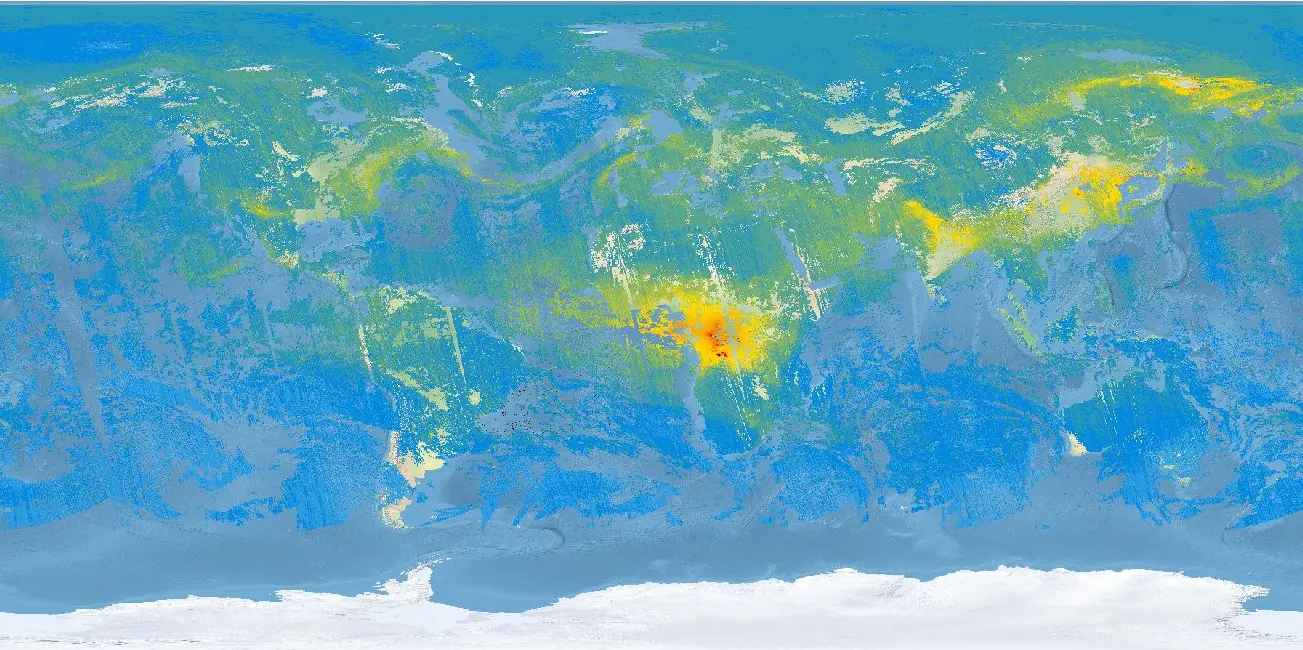
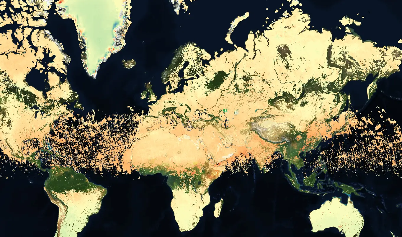
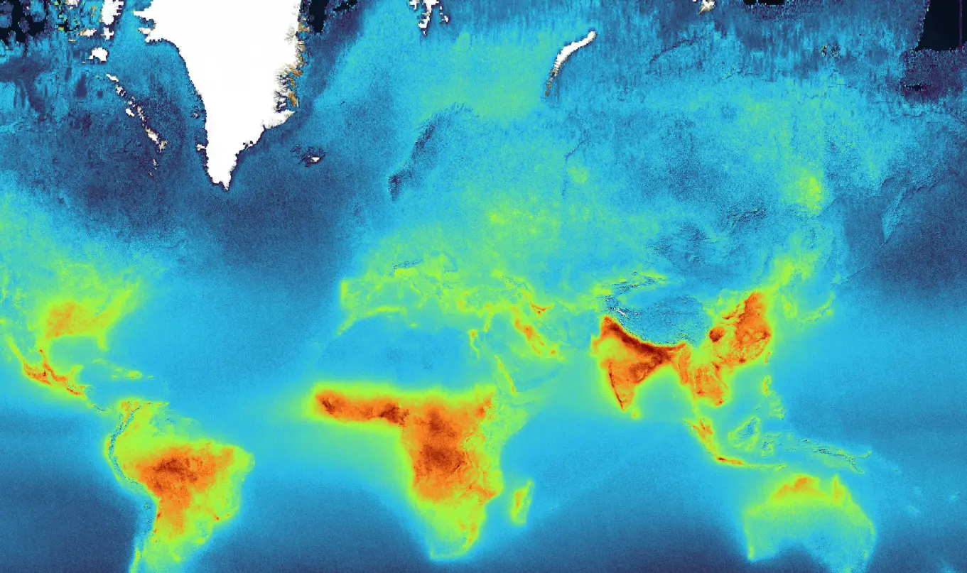
NO2 (global)
Sentinel-5P Level-3 NO2 Daily Product - V2
Contains binned Level-2 TROPOMI NO2 retrievals. The L3 binning algorithm weighs individual pixels with the overlap area of the pixel and the Level-3 grid cell. The weighing and count vectors are used to apply this weighted average consistently, see https://stcorp.github.io/harp/doc/html/libharp_product.html.
| Property | Value |
|---|---|
| Spatial extent | [-180, -89, 180, 89] |
| Temporal extent | 2018/05/01 - Current |
| DOI | 10.71570/dcgx-3979 |
The Algorithm Theoretical Basis Document (ATBD) for this collection can be found here.
Sentinel-5P Level-3 NO2 Monthly Product - V2
Contains binned Level-2 TROPOMI NO2 retrievals. The L3 binning algorithm weighs individual pixels with the overlap area of the pixel and the Level-3 grid cell. The weighing and count vectors are used to apply this weighted average consistently, see https://stcorp.github.io/harp/doc/html/libharp_product.html.
| Property | Value |
|---|---|
| Spatial extent | [-180, -89, 180, 89] |
| Temporal extent | 2018/05/01 - Current |
| DOI | 10.71570/khnn-pz89 |
The Algorithm Theoretical Basis Document (ATBD) for this collection can be found here.
Sentinel-5P Level-3 NO2 Yearly Product - V2
Contains binned Level-2 TROPOMI NO2 retrievals. The L3 binning algorithm weighs individual pixels with the overlap area of the pixel and the Level-3 grid cell. The weighing and count vectors are used to apply this weighted average consistently, see https://stcorp.github.io/harp/doc/html/libharp_product.html.
| Property | Value |
|---|---|
| Spatial extent | [-180, -89, 180, 89] |
| Temporal extent | 2018/05/01 - Current |
| DOI | 10.71570/rd1j-qx89 |
The Algorithm Theoretical Basis Document (ATBD) for this collection can be found here.
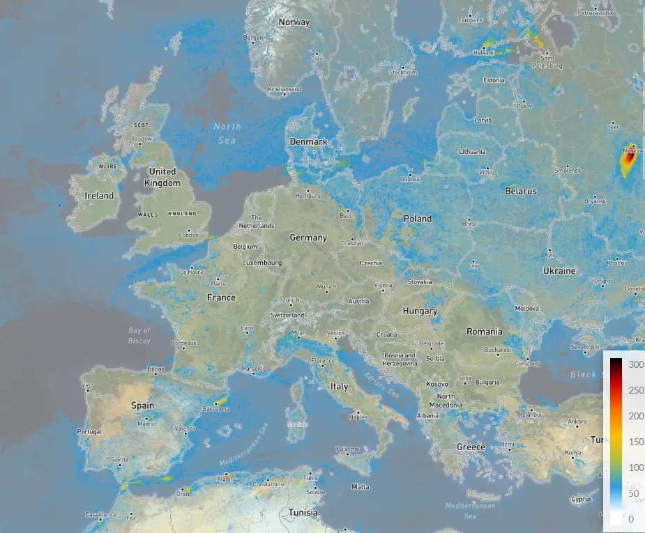
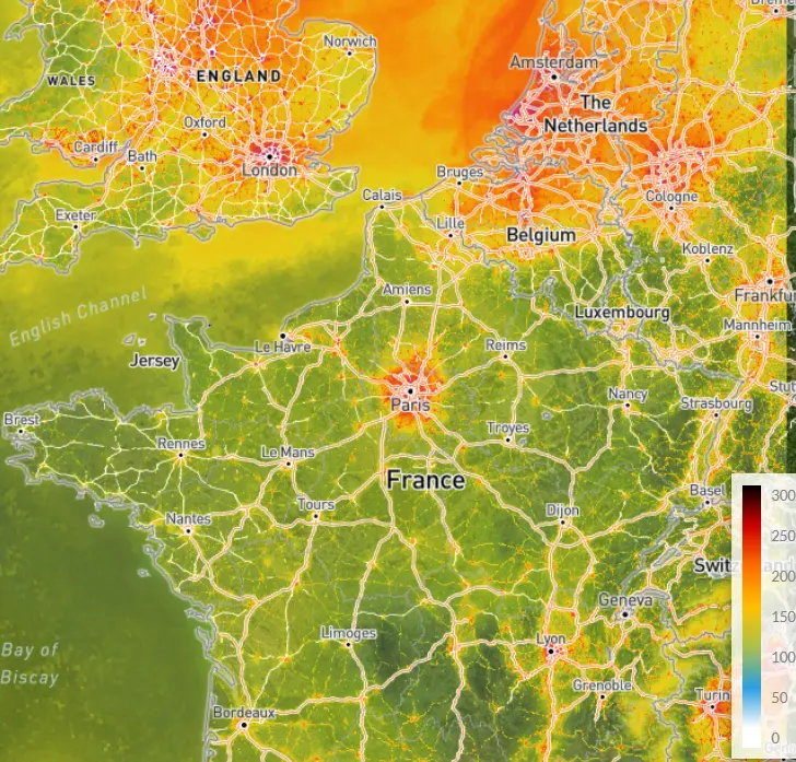
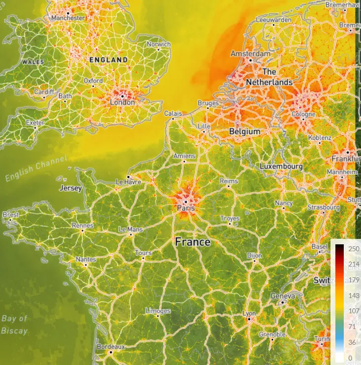
NO2 - CAMS (Europe)
Sentinel-5P Level-3 NO2 European with CAMS Daily Product - V2
Contains binned Level-2 TROPOMI NO2 retrievals using CAMS a-priori for Europe. The L3 binning algorithm weighs individual pixels with the overlap area of the pixel and the Level-3 grid cell. The weighing and count vectors are used to apply this weighted average consistently, see https://stcorp.github.io/harp/doc/html/libharp_product.html.
| Property | Value |
|---|---|
| Spatial extent | [-180, -89, 180, 89] |
| Temporal extent | 2018/05/01 - Current |
| DOI | 10.71570/hpwh-n814 |
The Algorithm Theoretical Basis Document (ATBD) for this collection can be found here.
Sentinel-5P Level-3 NO2 European with CAMS Monthly Product - V2
Contains binned Level-2 TROPOMI NO2 retrievals using CAMS a-priori for Europe. The L3 binning algorithm weighs individual pixels with the overlap area of the pixel and the Level-3 grid cell. The weighing and count vectors are used to apply this weighted average consistently, see https://stcorp.github.io/harp/doc/html/libharp_product.html.
| Property | Value |
|---|---|
| Spatial extent | [-180, -89, 180, 89] |
| Temporal extent | 2018/05/01 - Current |
| DOI | 10.71570/8bpy-yb56 |
The Algorithm Theoretical Basis Document (ATBD) for this collection can be found here.
Sentinel-5P Level-3 NO2 European with CAMS Yearly Product - V2
Contains binned Level-2 TROPOMI NO2 retrievals using CAMS a-priori for Europe. The L3 binning algorithm weighs individual pixels with the overlap area of the pixel and the Level-3 grid cell. The weighing and count vectors are used to apply this weighted average consistently, see https://stcorp.github.io/harp/doc/html/libharp_product.html.

| Property | Value |
|---|---|
| Spatial extent | [-180, -89, 180, 89] |
| Temporal extent | 2018/05/01 - Current |
| DOI | 10.71570/zzg2-w779 |
The Algorithm Theoretical Basis Document (ATBD) for this collection can be found here.
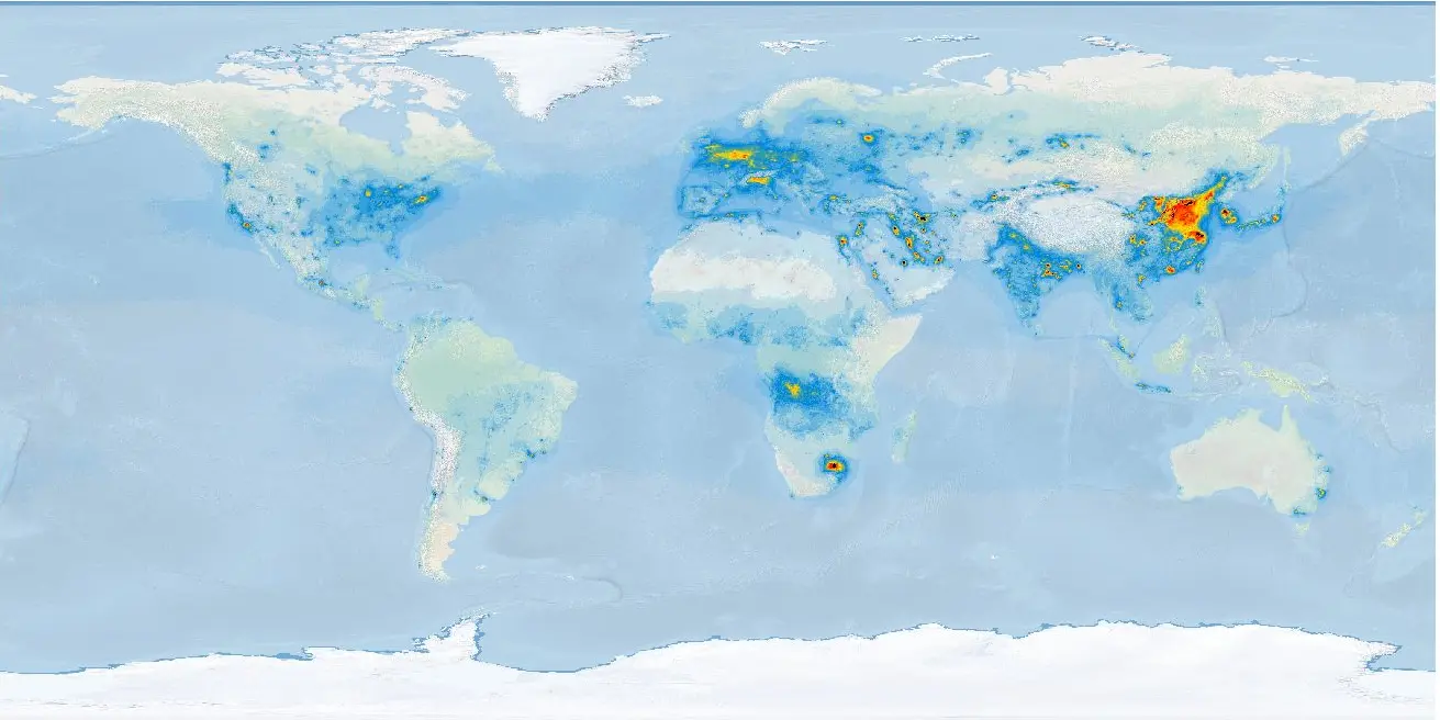
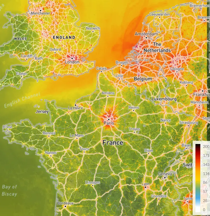
NO2 - surface level (Europe)
Sentinel-5P Level-3 NO2 Surface Daily Product - V2
NO2 surface concentrations [micrograms/m^3] based on Sentinel-5P/TROPOMI Level-2 retrievals using CAMS.
| Property | Value |
|---|---|
| Spatial extent | [-180, -89, 180, 89] |
| Temporal extent | 2018/05/01 - Current |
| DOI | 10.71570/wfq7-ec82 |
The Algorithm Theoretical Basis Document (ATBD) for this collection can be found here.
Sentinel-5P Level-3 NO2 Surface Monthly Product - V2
NO2 surface concentrations [micrograms/m^3] based on Sentinel-5P/TROPOMI Level-2 retrievals using CAMS.
| Property | Value |
|---|---|
| Spatial extent | [-180, -89, 180, 89] |
| Temporal extent | 2018/05/01 - Current |
| DOI | 10.71570/13qa-z770 |
The Algorithm Theoretical Basis Document (ATBD) for this collection can be found here.
Sentinel-5P Level-3 NO2 Surface Yearly Product - V2
NO2 surface concentrations [micrograms/m^3] based on Sentinel-5P/TROPOMI Level-2 retrievals using CAMS.
| Property | Value |
|---|---|
| Spatial extent | [-180, -89, 180, 89] |
| Temporal extent | 2018/05/01 - Current |
| DOI | 10.71570/edc0-3h63 |
The Algorithm Theoretical Basis Document (ATBD) for this collection can be found here.
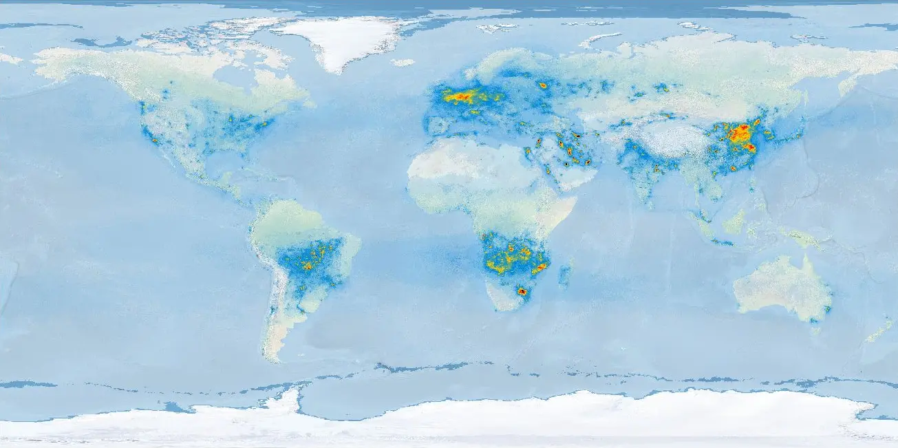
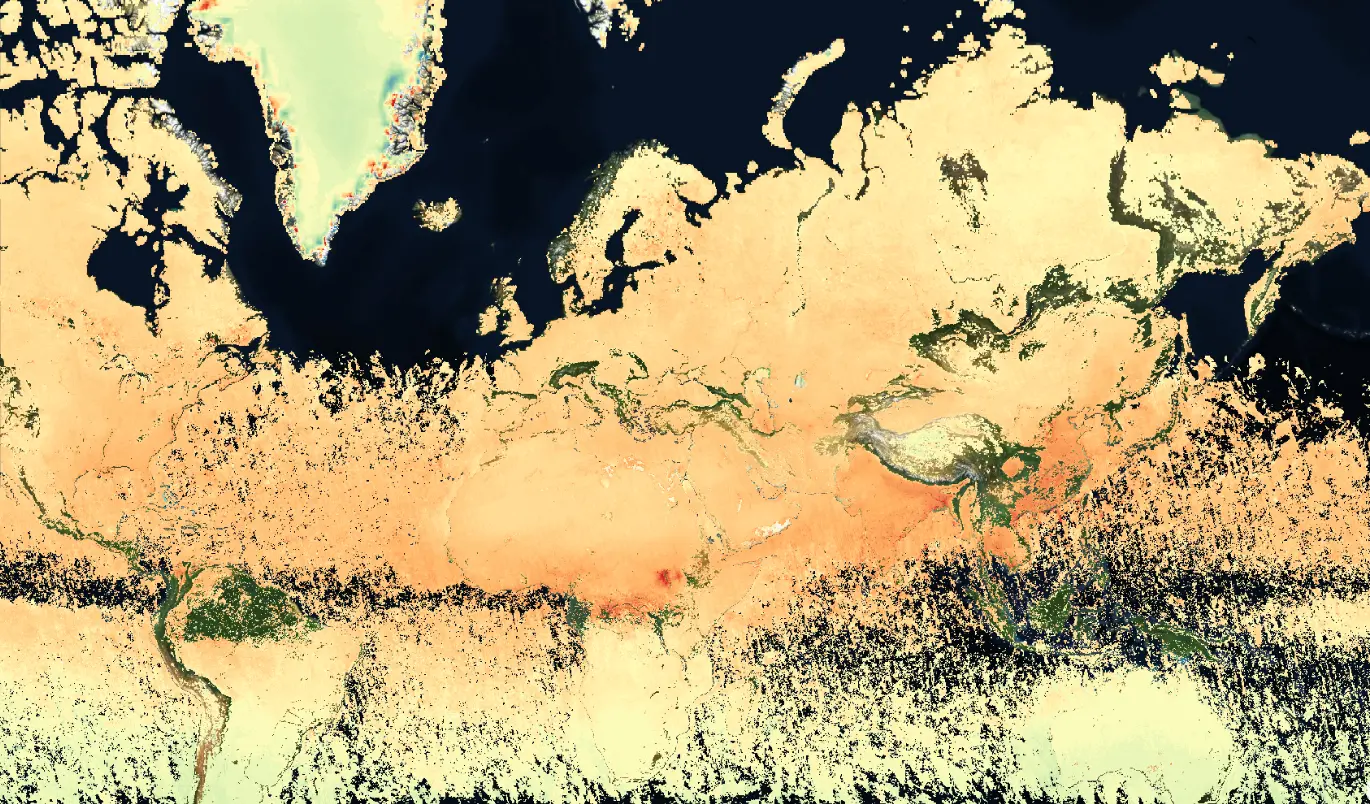
CO
Sentinel-5P Level-3 CO Daily Product - V2
Contains binned Level-2 TROPOMI CO retrievals. The L3 binning algorithm weighs individual pixels with the overlap area of the pixel and the Level-3 grid cell. The weighing and count vectors are used to apply this weighted average consistently, see https://stcorp.github.io/harp/doc/html/libharp_product.html.
| Property | Value |
|---|---|
| Spatial extent | [-180, -89, 180, 89] |
| Temporal extent | 2018/05/01 - Current |
| DOI | 10.71570/x3cn-2376 |
The Algorithm Theoretical Basis Document (ATBD) for this collection can be found here.
Sentinel-5P Level-3 CO Monthly Product - V2
Contains binned Level-2 TROPOMI CO retrievals. The L3 binning algorithm weighs individual pixels with the overlap area of the pixel and the Level-3 grid cell. The weighing and count vectors are used to apply this weighted average consistently, see https://stcorp.github.io/harp/doc/html/libharp_product.html.
| Property | Value |
|---|---|
| Spatial extent | [-180, -89, 180, 89] |
| Temporal extent | 2018/05/01 - Current |
| DOI | 10.71570/63r0-d516 |
The Algorithm Theoretical Basis Document (ATBD) for this collection can be found here.
Sentinel-5P Level-3 CO Yearly Product - V2
Contains binned Level-2 TROPOMI CO retrievals. The L3 binning algorithm weighs individual pixels with the overlap area of the pixel and the Level-3 grid cell. The weighing and count vectors are used to apply this weighted average consistently, see https://stcorp.github.io/harp/doc/html/libharp_product.html.
| Property | Value |
|---|---|
| Spatial extent | [-180, -89, 180, 89] |
| Temporal extent | 2018/05/01 - Current |
| DOI | 10.71570/hsp1-rq52 |
The Algorithm Theoretical Basis Document (ATBD) for this collection can be found here.
CH4
Sentinel-5P Level-3 CH4 Daily Product - V2
Contains binned Level-2 TROPOMI CH4 retrievals. The L3 binning algorithm weighs individual pixels with the overlap area of the pixel and the Level-3 grid cell. The weighing and count vectors are used to apply this weighted average consistently, see https://stcorp.github.io/harp/doc/html/libharp_product.html.
| Property | Value |
|---|---|
| Spatial extent | [-180, -89, 180, 89] |
| Temporal extent | 2018/05/01 - Current |
| DOI | 10.71570/9gt6-4r34 |
The Algorithm Theoretical Basis Document (ATBD) for this collection can be found here.
Sentinel-5P Level-3 CH4 Monthly Product - V2
Contains binned Level-2 TROPOMI CH4 retrievals. The L3 binning algorithm weighs individual pixels with the overlap area of the pixel and the Level-3 grid cell. The weighing and count vectors are used to apply this weighted average consistently, see https://stcorp.github.io/harp/doc/html/libharp_product.html.
| Property | Value |
|---|---|
| Spatial extent | [-180, -89, 180, 89] |
| Temporal extent | 2018/05/01 - Current |
| DOI | 10.71570/d4jb-hz91 |
The Algorithm Theoretical Basis Document (ATBD) for this collection can be found here.
Sentinel-5P Level-3 CH4 Yearly Product - V2
Contains binned Level-2 TROPOMI CH4 retrievals. The L3 binning algorithm weighs individual pixels with the overlap area of the pixel and the Level-3 grid cell. The weighing and count vectors are used to apply this weighted average consistently, see https://stcorp.github.io/harp/doc/html/libharp_product.html.
| Property | Value |
|---|---|
| Spatial extent | [-180, -89, 180, 89] |
| Temporal extent | 2018/05/01 - Current |
| DOI | 10.71570/f75g-fw96 |
The Algorithm Theoretical Basis Document (ATBD) for this collection can be found here.
HCHO
Sentinel-5P Level-3 HCHO Daily Product - V2
Contains binned Level-2 TROPOMI HCHO retrievals. The L3 binning algorithm weighs individual pixels with the overlap area of the pixel and the Level-3 grid cell. The weighing and count vectors are used to apply this weighted average consistently, see https://stcorp.github.io/harp/doc/html/libharp_product.html.
| Property | Value |
|---|---|
| Spatial extent | [-180, -89, 180, 89] |
| Temporal extent | 2018/05/01 - Current |
| DOI | 10.71570/ewbg-5a80 |
The Algorithm Theoretical Basis Document (ATBD) for this collection can be found here.
Sentinel-5P Level-3 HCHO Monthly Product - V2
Contains binned Level-2 TROPOMI HCHO retrievals. The L3 binning algorithm weighs individual pixels with the overlap area of the pixel and the Level-3 grid cell. The weighing and count vectors are used to apply this weighted average consistently, see https://stcorp.github.io/harp/doc/html/libharp_product.html.
| Property | Value |
|---|---|
| Spatial extent | [-180, -89, 180, 89] |
| Temporal extent | 2018/05/01 - Current |
| DOI | 10.71570/1m9p-th36 |
The Algorithm Theoretical Basis Document (ATBD) for this collection can be found here.
Sentinel-5P Level-3 HCHO Yearly Product - V2
Contains binned Level-2 TROPOMI HCHO retrievals. The L3 binning algorithm weighs individual pixels with the overlap area of the pixel and the Level-3 grid cell. The weighing and count vectors are used to apply this weighted average consistently, see https://stcorp.github.io/harp/doc/html/libharp_product.html.
| Property | Value |
|---|---|
| Spatial extent | [-180, -89, 180, 89] |
| Temporal extent | 2018/05/01 - Current |
| DOI | 10.71570/c3r4-qk51 |
The Algorithm Theoretical Basis Document (ATBD) for this collection can be found here.
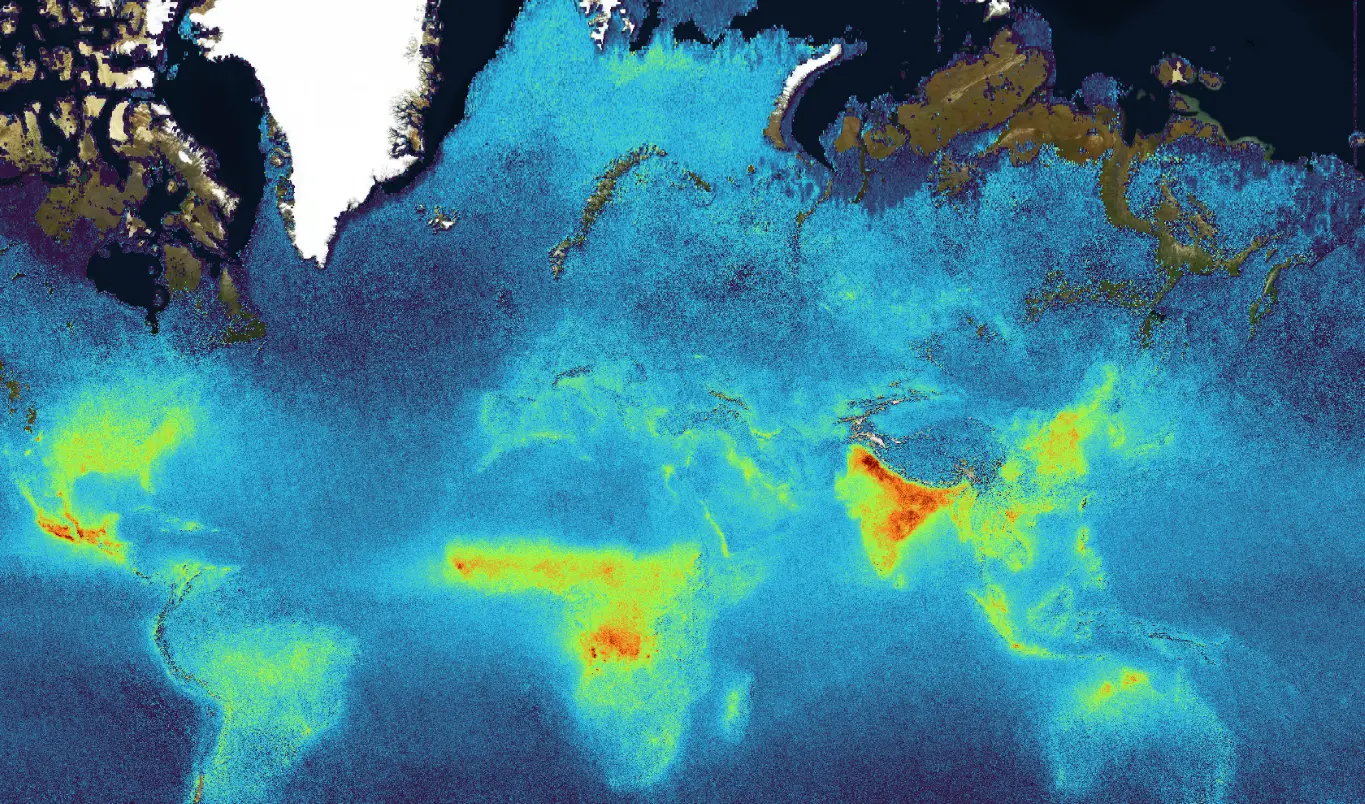
SO2
Sentinel-5P Level-3 SO2 Daily Product - V2
Contains binned Level-2 Sulfur Dioxide (SO2) vertical column products using COvariance-Based Retrieval Algorithm (COBRA) retrievals. The L3 binning algorithm weighs individual pixels with the overlap area of the pixel and the Level-3 grid cell. The weighing and count vectors are used to apply this weighted average consistently, see https://stcorp.github.io/harp/doc/html/libharp_product.html.
| Property | Value |
|---|---|
| Spatial extent | [-180, -89, 180, 89] |
| Temporal extent | 2018/05/01 - Current |
| DOI | 10.71570/dwrd-pa18 |
Sentinel-5P Level-3 SO2 Monthly Product - V2
Contains binned Level-2 Sulfur Dioxide (SO2) vertical column products using COvariance-Based Retrieval Algorithm (COBRA) retrievals. The L3 binning algorithm weighs individual pixels with the overlap area of the pixel and the Level-3 grid cell. The weighing and count vectors are used to apply this weighted average consistently, see https://stcorp.github.io/harp/doc/html/libharp_product.html.
| Property | Value |
|---|---|
| Spatial extent | [-180, -89, 180, 89] |
| Temporal extent | 2018/05/01 - Current |
| DOI | 10.71570/5xsg-3r41 |
Sentinel-5P Level-3 SO2 Yearly Product - V2
Contains binned Level-2 Sulfur Dioxide (SO2) vertical column products using COvariance-Based Retrieval Algorithm (COBRA) retrievals. The L3 binning algorithm weighs individual pixels with the overlap area of the pixel and the Level-3 grid cell. The weighing and count vectors are used to apply this weighted average consistently, see https://stcorp.github.io/harp/doc/html/libharp_product.html.
| Property | Value |
|---|---|
| Spatial extent | [-180, -89, 180, 89] |
| Temporal extent | 2018/05/01 - Current |
| DOI | 10.71570/brbk-2r88 |